

Input

The Geology Modeller also allows the application to model lithologies in a particular order (for example if the order was A then B, the application would only use drillholes where there is a contact between A and B and ignore those which have A and C contacting).
The tool provides the capability to model a geographical area in 3D, enabling you to visualise what is happening below the ground, identify trends and make drilling decisions based on your observations.
On the Input tab of the Geology Model form, specify the Dillhole Database that will be used as an input to the model.
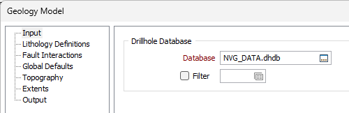
Drillhole Database
Double-click (F3) to select
Optionally, select or create a filter to limit the data that is processed.
If you select the Filter check box, you can select an existing filter or create one using the Expression Editor by clicking the icon.
Forms
Click the Forms button to select and open a saved form set, or if a form set has been loaded, save the current form set.
Run
When you have specified an Output file and the Target fields you want to assign to, click the Run button to begin the process.