

Pitram Zones
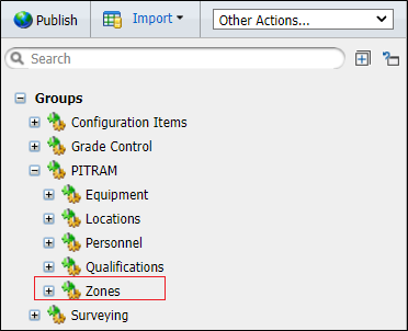
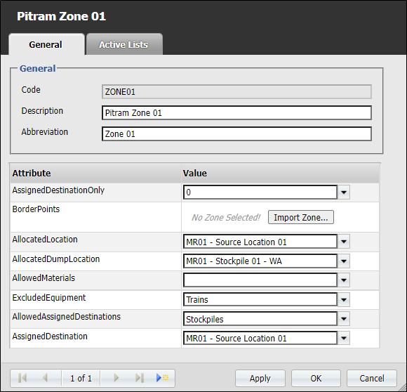
Zones are configured in the Pitram Reference Edit service. A zone is an area on site defined by a closed boundary. To identify the boundary of the zone, a polygon is digitised in Micromine Australia Pty Ltd (preferred) or some other third-party application. Each zone is defined in terms of a material type.
Zones are used to validate the movement of material between a source and a destination. The source, the destination, and the material moved must all have a material type that matches the zone. If there is any disparity, a warning is displayed on the Operator's Micromine Pitram Mobile screen. A similar warning message is issued to the Control Room Operator.
For example, if Zone_A is defined as:
|
Before you can display Pitram zones map data, you will need to ensure that the zones have been configured and published using the Configuring Zones.
Display
Use the Pitram | Zones menu option (or double-click on Pitram Zones in the Display pane) to view Pitram Zone properties.
|
|
The Zone Types, Zone Styles and Labels you can set for each Location are described below:
Zone type
Select the Alarm Zone option to configure the areas of the mine for which an alarm may be triggered. Typically, this will occur when there is a mismatch between the material that is handled by a unit of equipment moving into a zone, and the material type of the zone.
Select the Dispatch Zone option to configure the areas (mining locations and dumps etc.) that equipment units can be dispatched to.
Location
Select the Location you want to configure as an alarm zone or a dispatch zone.
Data from the database tables are mapped to zones in the ZoneDispatchMapping reference data group.
Zone style
Hatch field
Specify the name of the field containing the data that will control the hatching. The hatch set, that is associated with this field, maps hatch patterns to text strings or numeric ranges. For each record in the database, the hatch pattern that will be used is determined by the value in this field.
Hatch set
Double click (F3) to select the set that will be used to control the hatch pattern. The hatch set maps hatch patterns to text strings or numeric ranges. This determines the hatch pattern for each value in the Hatch field. Right click (F4) to create or edit a hatch set.
Hatch
Double click (F3) to select the default hatch. This will be used when a hatch set is not defined, or when the value in the hatch field is not mapped in the hatch set.
Label
Select the attributes that will be labelled in the display. For an alarm zone, the Location name and Destination code can be shown. For a dispatch zone, the Location name, Zone name, Material code, and Destination code can be shown.