Load Drillholes into Plan

There are a number of input methods:
Note that you can use any combination of methods, including all in conjunction.
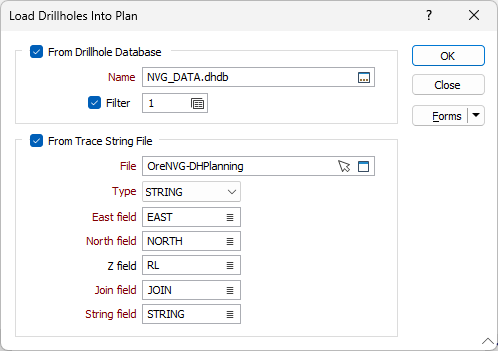
From Drillhole Database
Select this check box to load the drillholes in a Drillhole Database.
Name
Double-click (F3) to select the name of the database containing your data.
Optionally, select or create a filter to limit the data that is processed.
See: Filter
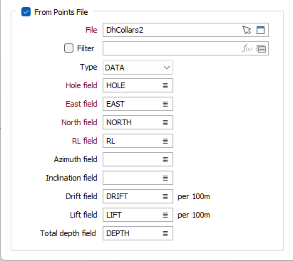
From Points File
Select the From Points File option to select a points file to use to load drillholes into the plan.
File
Select a file Type and then double-click (F3) to select the points File for loading into the plan. You can also click the Pick from Vizex button to collapse the form and interactively select a layer containing the file to be inserted and return to the form.
Hole field
Double-click (F3) to select the name of the field in the points file containing the Hole information.
East and North and Z fields
Specify the names of the fields in which Easting, Northing, and Z coordinates are stored in the Points file.
Azimuth field
Enter or select the name of the Azimuth field which contains information on drillhole azimuths. Azimuths are expressed in decimal degrees, with zero (0°) being grid North. Negative values and values greater than 360° are correctly evaluated.
Inclination field
Enter or select the Inclination field in the Points file. Inclinations are expressed in decimal degrees from -90 to 90, with negative values representing down holes.
Drift field
Enter or select the name of the Drift field in the Points file. Drift information measures the angular change in the horizontal plane (left/right 'bending') per 100m.
Lift field
Enter or select the name of the Lift field in the Points file. Lift information measures the angular change in the vertical plane (up/down 'bending') per 100m.
Total depth field
Enter or select the name of the Total depth field in the Points file.
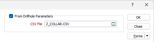
From Drillhole Parameters
Select the From Drillhole Parameters check box to specify a comma separated file containing the drillhole information to be loaded into the plan.
The CSV file can be exported from third-party software and should include the following expected columns:
-
Drillhole Name- Planned drillhole name
-
Easting - Collar Easting
-
Northing - Collar Northing
-
Elevation - Collar Elevation
-
Azimuth - Collar Azimuth
-
Dip - Collar Dip (Flipped inclination)
-
Lift Rate - Dip change amount used for deviation (Flipped for inclination change)
-
Drift Rate - Azimuth change amount used for deviation
-
Distance - Distance over which lift and drift are applied
-
Extension - Extra length added beyond Total Depth
-
Target Depth - Base planned drillhole length
-
Comment - Text Comment
CSV File
Double click (F3) or use the select icon to specify the .CSV file containing the drillhole information.
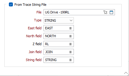
From Trace String File
Select a file Type and then double-click (F3) to select the input File that contains the trace strings you want to load into the plan. You can also click the Pick from Vizex button to collapse the form and interactively select a layer containing the file to be inserted and return to the form.
East and North and Z fields
Specify the names of the fields in which Easting, Northing, and Z coordinates are stored in the String file.
Join field
In forms that require polylines as an input, the values in this field define whether the data points in the input file should be joined by a line. If successive records have the same value in this field, a line will join the points. If two-factor topology is required, the values in a String field may also be used to segment the lines.
String field
In most forms, the String field is an optional generic attribute used to store a secondary input such as a code. Traditionally, this field has also been used with the Join field to define whether data points should be joined by a line, or strung, hence the name.