

Clipping Polygon
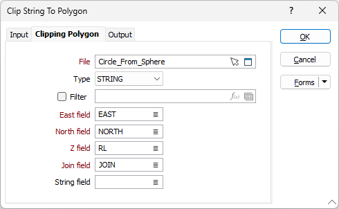
On the Clipping Polygon tab of the form, specify the file that defines the clipping polygon.
File
Select a file type and double-click (F3) to select the file containing the clipping boundary. You can also click the Pick from Vizex button to collapse the form and interactively select a layer containing the file to be inserted and return to the form.
Optionally, select or create a filter to limit the data that is processed.
Easting and Northing and Z fields
Specify the names of the fields in which Easting, Northing, and (optionally) Z coordinates are stored in the clipping strings file.
String field
(Optional) Specify the name of the field containing values which define whether data points will be joined by a line. The values of this field in successive records must be the same before the points will be strung.
Join field
Specify the name of the field containing values which define whether data points will be joined by a line i.e. strung. If successive records have the same value in this field and no String field is defined a line will join the points. If a String field is defined, then values in each field in successive records must be the same before the points will be strung.
Although it is implicitly assumed that the “clipping string” will be closed, the function will work for open strings (as per the interactive clipping function).